Having done very little training (a total of just 115 miles) since the six-day race back in April I was getting itchy feet and was keen for another adventure, so why not walk that same distance from Bangor across the North Cost of Wales and up to Liverpool?
I booked a train ticket from Euston to Bangor for Friday 9th June leaving at 5pm and arriving in Bangor at 8:30pm, and a train from Liverpool back to London for Sunday morning at 8:30am. Allowing for 30 minute each side that would give me a maximum of 35 hours for a walk that was likely to be around 112 to 115 miles – including a Nova Prestatyn parkrun at about 50 miles on Saturday morning.
I didn’t intend writing a report about my walk but I took a few photos along the way which I wanted to post here.
The start at 8:50pm on Friday nightSunset on night one. Looking over the Menai BridgeApparently this is the smallest house in Great Britain – Conwy, WalesSunrise on Saturday morningNova Prestatyn parkrun – I arrived with two minutes to spare and then walked 38 ½ minutes for the 5km before heading off towards LiverpoolMcDonalds in Flint – mandatory pitstopAfter walking in hot, sunny, 28 degrees all day it started to rain around 7pm and within minutes it was a torrential downpour with flash flooding – only ankle deep – but I was glad I had my plastic ponchoI finally arrived at the Beetles statue in Liverpool just before 4am, 31 hours after leaving BangorAnd then I walked up to my finishing point at Liverpool StationWhere I slept with the homeless and drunks for an hour and a half before going to McDonalds doe breakfast, having a sponge wash in the railway station toilets and catching the train home
The black line across the top of Wales is the result of my weekend’s work. I have now walked a non-stop line from the South of England up to London, over to Cardiff and then up to North-West Wales, and across the North Coast of Wales and up to Liverpool
It is two weeks since I finished my walk to all of London’s 270 underground tube stations and every night I’m still having strange dreams that involve London’s tube stations. Sometimes the dreams are mini nightmares in which I have finished my 325 mile walk only to discover that I missed one station. Often the dreams involve a strange combination of my current project at work, which involves upgrading a component of the software used by hundreds of UK accounting firms, but the accounting forms are now tube stations. And then there are the dreams that are so vivid when I’m asleep, but the moment I wake up I can’t remember anything about them.
My wife says that this was the hardest walk I’ve ever done, and I’ve now completed 32 walks of 100 miles or more. She says that it took 5 nights after I completed the walk before she was able to get a good night’s sleep again.
One thing that people who are not actively involved in ultra-distance sport may not realise is that the event involves much more than just the time the event takes to complete. There is the lead-up to the event, which often involves me having one or two restless nights sleep immediately beforehand (although not this time fortunately), and then there is the ‘afterwards’.
The first few times I competed in races of 100 miles or longer I found that the first night after the race I had terrible night sweats, often sweating so much that we would have to change the sheets in the middle of the night. Sometimes I would also be in so much pain that it hurt just to lie down, let alone roll over in my sleep. As I have become more experienced the night sweats reduced and sometimes disappeared altogether. The pain was always there and sleeping with a pillow under my feet sometimes helped, but Ruth got used to the fact that if I was going to do a long race/walk, she would probably lose part of a night’s sleep the night afterwards due to my groaning with pain throughout the night.
The reason that Ruth says this was my hardest walk to date is that I had night sweats for three consecutive nights after the walk was over and, apparently, I was both swearing and groaning in my sleep for five nights.
But was it worth it? Absolutely! Walking to every tube station in London was probably the best adventure I have had so far.
I’ve created this video which shows the 270 selfies I took in front of each tube station as proof that I had visited them all (plus some additional photos), but there was so much more to the adventure than I had time to talk about in the ten minutes within the video.
Preparation:
After completing a solo circumnavigation of Surrey in early August, and with all the races I wanted to do over the summer either being cancelled or postponed I started looking for another adventure. In July, when planning for the Surrey circumnavigation I had come up with an idea for a 7 day walk which I don’t think anyone has done previously (which is why I’m not going to tell you what that walk is yet) but the idea for that particular walk scared me so much that I’ve put that on my list for consideration next year instead. I then heard about a guy setting a new Fasted Known Time (FKT) for the Wainwrights – the 214 highest peaks in Cumbria – and that started me thinking about a London version of this where I would visit tube stations rather than peaks.
For a little while I considered attempting the Smog Graham Round which is visiting the highest peak in each of London’s 32 boroughs but on investigation, I found that some of those ‘peaks’ (which range in height from 22 meters to 245 meters) are on private property which may not always be accessible, so I downloaded a file I found online containing the postcodes of all 270 tube stations and set about identifying the most efficient/shortest route that would enable me to visit all the stations in one very long walk.
One idea I had was to take the tube all the way up to Chesham, the most north easterly tube station and then walk from there to Upminster in the west via every tube station in between. But the Wainwrights and all the other famous ‘rounds’ generally start and finish at the same point, and I also decided that with Covid-19, I would prefer to avoid actually going into a tube station or on a train/tube if I could.
Richmond Station, which is the end of the District Line, is only a few miles from where I live and I decided that would be the ideal start/finish point for this mammoth walk.
I used a combination of Google Maps, Notepad++ and two GPX creation websites to map a suitable route, convert the Google Maps routes (which could only contain a maximum of 18 waypoints between each start and finish and therefore required multiple maps) into GPX files, consolidate them into one XML file, and then finally produce one consolidated GPX file for me to visualize my planned route.
I’m not convinced that my planned route was the absolute shortest it could be (and it definitely wasn’t with the extra mileage I had to walk during the adventure) but after several iterations I think I was reasonably close – it was definitely shorter than the shortest route that I could calculate using a trial version of some commercial software I downloaded for delivery drivers to calculate their routes.
Other than planning my route I did very little preparation except for purchasing enough food to keep me going for the first 24 hours and packing some warm clothes and other equipment that I would need during the walk.
Day 1 – Thursday 3rd September
Breaking this particular walk down into days might not be the best way to write about it, especially as it was really a walk of two parts (as you may already know if you’ve watched my video), but hopefully it makes this report more readable.
Day 1 started with my wife dropping me off at Richmond Station just before 9:30am and taking this ‘starting photo’ outside Richmond Station. I was using a photo app that adds date/time stamp plus other information to every photo as I wanted to have proof that I had visited all stations and be able to show when I reached each station – just in case anyone ever questions whether I really did this. And assuming that I successfully completed the walk I intended on registering this as a Fastest Known Time on the FKT website and also applying for a record with Guinness Book of Records (incidentally, the fastest time recorded by anyone visiting all 270 tube stations is 15 hours and 45 minutes). Edit: Guinness Book of Records advise that they won’t recognise a record for visiting all tube stations on foot because it isn’t possible to get to Heathrow Terminal 1 on foot.
As you would expect in a five day walk, the first day was reasonably uneventful except for two problems:
When I arrived at Heathrow airport terminal 4 I discovered that it was closed due to Covid-19 meaning that the closest I could get to the tube station was the front door to the terminal, about 50 meters from the tube station itself. The FKT website have accepted this as being OK and I am hopeful that Guinness Book of Records will also accept this as otherwise this particular challenge is not possible to complete until terminal 4 re-opens, and the airport authority has no plans to do that in the near future.
When I was almost at Uxbridge my phone battery life had gone below 10% and the screen had turned itself off to conserve battery. This meant that I couldn’t see the map to help me find the tube station and I had to stop and recharge the phone enough so that I could turn the screen back on. I didn’t actually know that the phone had a setting to turn the screen off when the battery power was too low and initially I thought that maybe my phone was about to die, which would mean the end of my walk.
It also started raining soon after I left Uxbridge, but it only rained lightly for no more than an hour, so wasn’t really a problem.
Day 1, or at least Thursday (14 ½ hours), ended with me having visited 31 of the most westerly stations and heading towards Chesham at the end of the Metropolitan line.
Day 2 – Friday 4th September
I passed under the M25 at about 1:20am heading towards Chorleywood. I recognised the road I was on from my two walks circumnavigating the M25 motorway on 2016 and 2017. I often notice this when I’m out training. I walk down a road and recognise it even although it might have been years since the last time I was there.
The stations were reasonably spread out and it was taking me 30 to 60 minutes between each station but this was nothing compared to the three hours it would take me to get from Chesham (station 37) to Watford (station 38), where I stopped for breakfast, and then another two hours through to Stanmore (station 39).
My plan had always been to visit all the outer stations first and I had now visited most of the stations to the west of London. Next up were the tube stations across the north of London before the stations to the east and south before eventually arriving in London itself on Sunday or Monday. I figured that it would be easier mentally if I left all the inner-city tube stations to last.
I also planned on having my first sleep on Friday afternoon, and then sleeping for a few hours each afternoon for the remainder of the walk. I wanted to do this walk as a solo self-supported adventure which meant I couldn’t accept help from anyone during the walk, and therefore needed to sleep rough along the way. For this reason, I also decided that I would use the walk as a fundraiser for Centrepoint, a charity that helps homeless youth in the UK, and I ended up raising over £2,000 for them.
But when I stopped for my first sleep in a park between Dollis Hill and Neasden on Friday afternoon, I found that I couldn’t sleep. This was partially due to two foreign speaking people sitting down not too far away from me, lighting up a joint and carrying on a loud conversation in their own language, and partially because I just wasn’t ready for sleep. After resting for about an hour I decided to start walking again and I had another unsuccessful attempt at sleeping a few stations later.
The problem with not sleeping on Friday afternoon was that I knew that it would get too cold to sleep outside overnight. I had some warm clothing, but to stop and sleep outside, even with the warm clothing on, would be too cold and I wasn’t prepared to sleep anywhere that wasn’t in the open due to safety reasons.
Day 2 ended at Highgate, station 77, almost exactly 200km (124 miles) into my adventure. When I planned my route I estimated that, with a small allowance for getting lost and detours, the total distance would be around 500km (310 miles). This meant that I had covered 40% of the total estimated distance but only visited 28% of the 270 stations so far.
Day 3 – Saturday 5th September
I have done a few walks where I haven’t slept for 40+ hours but I was starting to get tired now. It was also raining lightly on and off so even if I had found somewhere safe to sleep the weather wasn’t going to let me sleep for too long.
Somewhere between High Barnet and Cockfosters (outside number 62 Station Road, New Barnet, according to the location stamp on the photo) I came across a sofa that someone had left outside their house and I thought that perhaps if I took the squabs off the sofa and turned them over, I could sleep on the dry side of them for a little while. To my surprise the sofa turned out to be a sofa-bed and I pulled it out and lay down on it. I think I may have slept for 10 minutes and in total I was there for 20 minutes before I had to start moving in order to warm up again.
And then at about 5:30am, as I was entering Southgate I came across an outdoor pub that not only had a roof but also padded bench seats. I lay down on one of the seats and may have slept for 45 minutes, but if I did sleep it was a restless sleep as I remember constantly making sure that I didn’t fall off the seat. My watch shows that I was stopped for about an hour and I definitely felt better after my ‘sleep’.
When I got going again, I was kind of just going through the motions. I knew what I was doing but it was almost like an out-of-body experience as I walked from one station to the next, taking one selfie after the other.
On my phone I had a list of all the tube stations, in the order I needed to visit them, and as I got to each station I deleted the station from the notepad file so as to easily keep track of where I was going. Against Bounds Green I also had a reminder that a friend in New Zealand came from Bounds Green and I took some photos of the local school and shops which I sent to her via facebook.
By late morning I was ready for a sleep but even in sunny parks the grass was still wet from the overnight rain and I was too sore to try sleeping on a park bench, although in hindsight I probably should have tried.
Eventually near Wanstead I found a park with a nice dry bit of grass and sat down and took my shoes and socks off so that my feet could air while I tried sleeping again. I think I may have managed another 45 minutes sleep but woke up in the shade and feeling cold again. I drained my blisters, taped my feet and put on a clean pair of socks, and then resumed walking.
By the time I arrived in Loughton (station 106), the last station before crossing the M25 again heading towards Epping, I was craving pizza – until I saw a KFC. I stopped for an early dinner and a short rest, which turned out to be a good idea as immediately after Loughton was a long, steep uphill slog, and I didn’t actually pass another suitable fast food place until the next morning (other than the pizza shop about 50 meters up the road from KFC).
I arrived in Epping just before 8pm and then headed south back towards north east London. Fortunately, I enjoy walking at night because the stations were well spread out. I was also feeling good despite the serious lack of sleep I had had so far – less than two hours sleep in the 2 ½ days I had been walking.
By the end of day 3 I had walked another 90km (56 miles) and was almost at station 112.
Day 4 – Sunday 6th September
Just after midnight I stopped at a petrol station to buy a drink and while waiting to be served I plugged my phone in to my portable USB charger to recharge as the remaining battery life was getting low again. But when I got to the next tube station I noticed that the phone wasn’t charging. I was carrying two heavy duty USB chargers, weighing 500 grams each (so about 1/7th of the total weight I was carrying with 1 litre of water being another 1/7th) and switched to the second charger. But my phone still wouldn’t charge!
I checked the USB chargers by charging my watch. That charged OK, so I made the assumption that it was the phone charging cable that wasn’t working and walked back to the petrol station to see if they sold charging cables. Fortunately they did, and even more fortunately, the new cable worked. I was so reliant on my phone, both for the list of stations to visit and the order to visit them in, and also for navigation using Google Maps. If my phone had died, my walk would have been over.
A short while later I arrived at Newbury Park tube station which was the last station I needed to visit on the Central line. From memory the station was quite busy – it was 1:20am on Sunday morning – so I quickly took my selfie and then got on my way again, wanting to avoid any drunken locals. This time I was heading south east to Upminster Bridge and then Upminster at the east end of the District Line. It was another long slog taking over 2 ½ hours to cover just over 14km but given that I had now been walking for over 65 hours on very little sleep I was maintaining a good pace.
In order to get to the very end of the District Line, Upminster, I had to pass the Upminster Bridge tube station which I would also pass again on my way west back towards London. I took a selfie outside Upminster Bridge at 4:03am and then 54 minutes later I arrived at Upminster station, just 1 mile down the road. In between times I came across a block of houses that had garages underneath (at road level) without garage doors. One was completely empty. One had security lights that came on when I went to go inside, and the middle one had a car in front of it.
I decided that the first one would make a good place to try and sleep and lay down on the hard, cold concrete floor at the back of the garage. It turned out that hard cold concrete and sleep don’t go together. It was another unsuccessful attempt at sleeping, but a few minutes off my feet which was much needed.
The fact that it took me 54 minutes to walk 1 mile indicates that I was probably resting for about 30-35 minutes and that made an incredible difference. That and the knowledge that I was now heading towards London. My kilometre split times on Strava don’t show it, but for the next few hours I felt like I was flying – although in reality my fastest kilometre was 10 minutes and 17 seconds!
I can’t remember which came next. Soon after daylight I stopped and brought some breakfast – just some yoghurt – from a shop I passed. And either just before or after that I had a weird sensation of déjà vu – in that I felt like I had been here before. In a way I had been here before. In 2016 I walked the District Line but in the opposite direction to what I was doing now, so I hadn’t actually seen what I was seeing in front of me, as it has been behind me last time.
I had the same sense of déjà vu last year a few hours before things started to go wrong for me in the Lon Las Ultra in Wales, but this time I was actually feeling good and having déjà vu. I’ve heard about other ultra-distance athletes experiencing déjà vu during multi-day events, so I guess it isn’t uncommon. I was still aware enough to know that something wasn’t right though, but as I have since discovered, I wasn’t aware enough to do anything about it – like eat some foot perhaps.
Anyway, I continued walking, feeling good/reasonable most of the time and I arrived in Stratford at 10am. It was a beautiful sunny morning and I decided that it would be a great idea to go into the Olympic Park and lie down in the sun for a sleep. Dumb idea! If you want to sleep, find somewhere away from people, not where tourists and locals are going to walk past you every few minutes.
As it turned out, when I lay down my legs decided that they were too sore to sleep and I couldn’t get comfortable, so after resting for about an hour I decided to start walking again.
This time the rest had had the opposite affect to my rest in Upminster. I felt terrible and really struggled.
My mind started to get confused. I ended up at a DLR station called Star Lane but was convinced that I was at Canning Town (which is a combined tube and DLR station) and I started to think that perhaps Transport For London and renamed the DLR to ‘Star Line’ (I had miss-read the station name) as a part of the Cross Rail construction project. I crossed from one side of the station to the other, and back, at least twice. But I couldn’t find a sign saying Canning Town. I eventually checked Google Maps and found that I wasn’t yet at Canning Town.
And then when I finally got to Canning Town I couldn’t work out how on earth I was supposed to get from one side of the station to the other as per the Google Maps navigation to get through to the next station.
Add to that, I had just discovered that the Greenwich foot tunnel which should take me through under the Thames to North Greenwich was currently closed in the weekends due to Covid, and therefore I was going to have to make a change to my route and go the long way to North Greenwich, and my mind was really starting to fall apart.
Since finishing I have also realised that I didn’t eat much/anything at all on Sunday other than the yoghurt I purchased at around about 7am’ish for breakfast. I used my phone to pay for all my food purchases throughout the walk as that was much easier than trying to deal with physical money, and my bank statement only shows the one purchase, for £1 on Sunday. I think/hope that I ate something, but it would have only been small snacks and maybe some fruit that I was still carrying from last time I had stopped to buy supplies on Saturday.
I do remember stopping at a pizza place in the east end on Sunday afternoon, but they told me the pizza would take 30 minutes to cook and I didn’t want to wait.
If I had been able to think clearly enough to stop and eat, what happened on Sunday afternoon/evening may not have happened. But that is easy to say now, two weeks later.
After leaving Canning Town I walked through to Canary Wharf where I again got totally confused, partially due to some road closures, and then from there via the east end stations through to the Rotherhithe Tunnel, a mile long car tunnel which would take me through to the Canada Water tube station on the south side of the Thames.
After emerging from the tunnel I found another park and again, I lay down in the sun in the hope of getting some sleep. However, the moment I stopped walking and lay down my whole body started shaking uncontrollably as if I was freezing cold. There was no way I was going to be able to sleep, and I also knew that there was probably no way I would be able to last another night without sleep.
I called my wife, Ruth, and told her about the situation. She said that I was going to have to come home and try and get some proper sleep in my own bed – which made sense to me – but as I felt good’ish when I was walking I suggested that I walk to North Greenwich first and from there I would walk to Wimbledon where she could collect me. Due to Covid I wasn’t too keen on taking public transport to get home, and it would take her hours to drive to where I was. The idea made sense to me, and I convinced Ruth that I would be in Wimbledon no later than midnight and would call her when I was almost there.
That was at about 7:30pm. 1 ¾ hours later I had arrived at North Greenwich (6km in the opposite direction to Wimbledon), and it was then that I realised that there was no way I would get to Wimbledon by midnight.
My walking felt extremely slow now, and I was ready to give up completely. I eventually made it back to the Canada Water tube station at 10:50pm and stopped my watch, deciding that that was enough. My walk was over!
Total mileage 377km/234 miles. 139 tube stations visited in 3 days, 15 hours, and 20 minutes.
I caught the tube from Canada Water to Waterloo and the train home to Richmond from where my son Zac collected me and took me home.
As soon as I got home, I had a shower than then went to bed. And surprise, surprise. I slept for 9 hours!
Day 5 – Monday 7th September
When I stopped at Canada Water tube station on Sunday night, I thought my attempt to visit all 270 tube stations was finished. I was mentally exhausted and physically tired.
But after a good sleep, and with a little prompting from Ruth I decided that I would continue what I had set out to do. At that stage I think I had raised about £800/£900 for Centrepoint and I didn’t want to let down those people who had donated. And I also knew deep down that I would be disappointed in myself if I didn’t continue.
I slept another 3 hours in the afternoon and then after dinner Zac took me back to Richmond station and I made the return trip back to Canada Water tube station arriving at about 10:30pm.
I waited until 10:50pm as, being a little OCD, I thought it would be best to resume walking exactly 24 hours after I had stopped.
It only took 20 minutes to walk through to Bermondsey tube station and by midnight I had passed Southwark tube station and was almost at Waterloo.
Total distance on Monday – just 5km. Total distance since the beginning – 382km. 143 tube stations visited.
Day 6 – Tuesday 8th September
I wasn’t walking fast but I enjoyed walking through the night. I arrived at Wimbledon tube station (station number 162) a little after 4am – this was the station that I thought I could have got to by midnight on Sunday night when talking to Ruth via phone at 7:30pm on Sunday. Obviously that estimate was way off, even if I hadn’t had the 24 hour break.
My first rest was just before 6am when I sat down in a park between Parsons Green and Fulham Broadway. On Friday afternoon I had sent an email to everyone at work telling them about my fundraising for Centrepoint and I thought I would send them an update as many of the donations I had received had come from my work colleagues. The email achieved the result I wanted and donations from my work colleagues started coming in again on Tuesday. Watching the donations grow helped with my motivation throughout the final 24 hours.
I was now in London and the distance between tube stations was measured in hundreds of meters rather than kiometers.
All entrances to London City are marked by a dragon
By 10:50am, 12 hours after resuming, I had walked another 60km (37 miles) and visited 55 tube stations. Mentally I was feeling good. Physically I was feeling OK. I couldn’t walk any faster than I was, but I didn’t need to. The important thing was that I was walking with the knowledge that I would finish this adventure.
Again, it was a nice sunny day and when I arrived at Leicester Square just after 3pm I decided to have one last long rest and sit down in the sun outside Burger King with my feet up.
I could have sat there all afternoon but after about half an hour I got moving again.
Going into the night I did have one moment where I was a little concerned for my safety. I can’t remember exactly where it was. Somewhere around the Ladbrook Grove or Latimer Road tube stations Google Maps took me through a housing estate and I walked past a group of young people who looked a bit menacing. Fortunately they were more interested in their skateboards than me, but over the whole walk that was the only time that I had any concerns about safety, and I suspect I walked through a number of other suburbs that may not be 100% safe.
Just before midnight I arrived at Hammersmith tube stations – two stations, one for the District and Piccadilly lines and the other across the road for the Hammersmith & City and Circle lines.
It was at this stage that I was finally able to start thinking about how far, or how little, I had to go. Only 20 stations (including Hammersmith) and less than 30km (19 miles).
I have learnt over the years that in any long distance walk you cannot afford to think about how far you have to go, or even how far you have been. You need to focus only on the here and now so as not to be overwhelmed by the overall distance/time of the walk. Up until now, as much as possible, I had focussed on one tube station at a time. Nothing more. But now, I was on the home straight!
Day 6 totals: 252 tube stations now visited. Total mileage 496km (308 miles)
Day 7 – Wednesday 9th September
I had started my walk the previous Thursday morning, and it was now Wednesday. One awesome week!
But it wasn’t over yet. There were still another 18 tube stations to visit and as I discovered when trying to find the North Acton tube station, things could still go wrong. Google Maps doesn’t seem to know that cemeteries are often locked at night, and at about 2:15am it wanted me to walk through a cemetery on the way to the tube station. Eventually I found my way around the cemetery and more importantly I was now counting down – only 8 stations to go!
It’s not over until it’s over though, and the last 3km (2 miles) from Kew Gardens through to Richmond was a real struggle. I was walking at a reasonable speed but I was falling asleep on my feet and had to have several micro sleeps where I simply stopped walking and leaned against a fence with my eyes closed for 20 to 30 seconds. If I hadn’t of been so close to the finish I would have sat down for a rest, but I was almost there!
The finish!
The finish was an anti-climax. As I approached Richmond Station I saw on the electronic sign at the bus stop that my bus from Richmond to home was only 1 minute away. So I quickly walked over to where I had started the previous Thursday morning, stopped my watch, and took a ‘finisher’s selfie’, then walked back to the bus stop, put my face mask on, and got on the bus for the short trip home.
Total time: 5 days, 20 hours, 18 minutes, and 3 seconds.
And when I got home everyone was asleep. It was only just after 6am. I had a shower and went to bed.
Some final thoughts:
I can go faster.
Most of the races, especially the race-walking races, that I want to do are in Europe and therefore unavailable to UK based athletes during the current crisis. If that continues into next summer, I would like to have another attempt at this walk. Next time I will do it with support. I think if I had people either following me throughout or meeting me at tube stations to feed me, give me everything I need, and if I have some places lined up to sleep when I need sleep, and I don’t need to carry 7 kilograms of food, water and equipment, I think I could complete this walk in under 100 hours, maybe inside 4 days.
In total, my watch recorded the walk as being a total of 538km (334 miles) but this included 4km recorded when I had to catch the bus from Bath Road to Heathrow Central bus stop and return in order to visit the tube station within the airport terminal – the only tube station not accessible by foot because it is within the airport parameter. And it also includes some additional mileage that my watch was recording when I was inside shops buying food. By my calculations the watch recorded an additional 10-11km that I didn’t walk (plus the 4km) so my estimate is that total distance walked was 523km (325 miles).
My walk on Strava can be viewed here – part 1, and part 2.
Today, I’ve used Google Maps to compare the route I had intended to take to get to the North Greenwich tube station to the route I actually took, and there is only a 3km (2 2 mile) difference. At the time, I thought the detour was adding 10km or more to my journey and that really messed with my mind.
Ultra-distance events such as this are more about mental strength than physical. You need both, but as the saying goes, “an ultramarathon is 90% mental, and the other 10% is in your head”
Until a couple weeks ago I thought I lived in Surrey. I moved to England in 2008 and have lived in the village of Ham, beside the river Thames halfway between Kingston and Richmond for most of the last 12 years. And in all that time, I have put ‘Surrey’ at the bottom of my address.
But a couple of weeks ago I discovered that we don’t live in Surrey at all.
My discovery came about because Management at work (which I also thought was in Surrey but it isn’t) asked all staff to think about doing something in August that would challenge us. For me, the word ‘challenge’ means doing something that I don’t know if I will be able to complete, and my first thoughts were that it would need to be a long walk – maybe a walk around Surrey.
My attempt at baking Ruth a Birthday cake – I forgot to add the eggs!
My manager told me that the ‘challenge’ didn’t need to be physical, although most of my work colleagues seemed to be choosing challenges such as couch to 5km, running a certain distance in under a certain time, or cycling, rowing, etc. She even said that the ‘challenge’ could be something like baking a cake – I wondered if she was referring to my attempt to bake a Birthday Cake for my wife back in March when I forgot to add the eggs to the cake mixture – but again, my idea of a challenge is something that I don’t know if I can achieve, and I know I can bake a cake if I really want to.
So I decided that my work challenge would be to walk a lap around Surrey, and it was then that I discovered that I didn’t actually live in Surrey!
How could that be? The Surrey County Council offices are in Kingston. I have passed them many times over the years. But Kingston isn’t in Surrey?
Well it turns out that Kingston was ‘moved’ into the county of Greater London in 1965 (55 years ago) but the Surrey County Council decided to remain based in Kingston, and most residents still refer to Kingston as being in Surrey.
So I actually live in Greater London, and not Surrey.
Not to be deterred, I decided that I would still walk a lap around Surrey as my challenge for work and I set about mapping a route that would be suitable. In 2016 and 2017 I walked a lap around the outside of the M25 motorway and my rule for those walks was that I had to walk as close to the motorway as possible, but I couldn’t cross under or over it, and obviously couldn’t walk on the motorway itself. I set a similar rule for the Surrey Circumnavigation – I had to stay on the outside of the Surrey border during the walk, but keep as close as possible to the border throughout. The idea being that I would walk a lap around the outside of Surrey without every crossing into Surrey itself.
Surrey circumnavigation route – the black line is the Surrey county border and the blue line is the route I planned to walk
As with the mapping of the M25 routes, and some other walks I done over the years, I used MapMyRun.com to plan my route. But this time, I switched the map view to use ‘World Topo’ view which showed me the county boundary lines. I measured an initial route and discovered that there were many other places where I would have to walk many extra miles to avoid what would have been a much shorter walk if I took a shortcut into Surrey, but rules are rules. My initial mapping showed that I would need to walk approximately 209 miles (337km). This would be my longest walk outside of a race, and my 5th longest ever.
I decided I would do the walk during the first weekend of August as a) that met the requirements for our ‘August challenge’ at work, and b) I didn’t have any commitments at work during the first week of August so could take a couple days leave if needed. I booked the Monday off work as annual leave and marked the Tuesday as ‘Annual Leave TBC’ in my calendar in case I needed the Tuesday as well.
I also re-mapped the route I would take, starting at Grayshott which is a small village on the Surrey/Hampshire border, just off the A3 meaning that it would be easy to get to via car. The benefit of starting in Grayshott was that I would be able to meet my wife/sons for a decent feed near Kingston on the Sunday afternoon/evening, and also change clothes, and pick up additional snack food, etc. It also meant that I would have to finish, as I would need to get back to Grayshott to collect the car.
And that was about as much planning as I did – identify a start/finish location, map out a route and download it to my phone, pack the food and equipment I would need for the walk plus additional supplies for when I would meet Ruth on the Sunday, and then wait until the morning of Saturday 1st August 2020 for the walk to begin.
Grayshott to Gatwick:
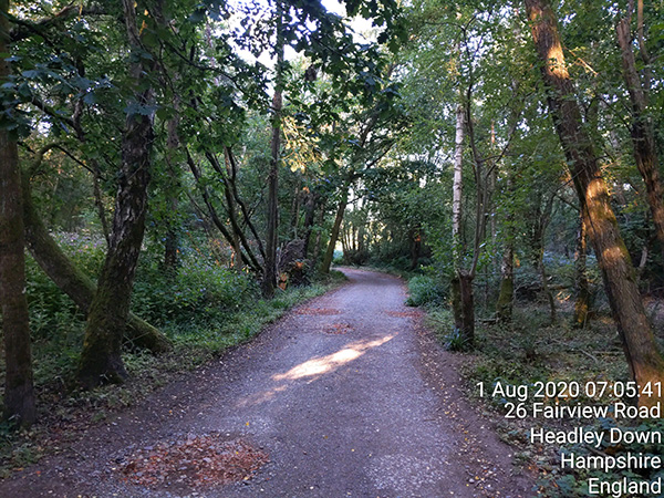
On the Saturday morning I woke when the alarm went off at 4am, had my normal breakfast of porridge and yoghurt and then drove down to Grayshott, about 40 miles away by car. I found a quiet, safe looking street to park the car and a suitable ‘landmark’ to use as my start/finish line – the Grayshott village hall – and after taking a ‘start’ selfie I headed off on my adventure at 6:35am.
My ‘start selfie’. Note the date/time stamp in the bottom right of the photo.
Within two minutes I had missed my first turnoff and had stepped into Surrey! I had downloaded my route to the MapMyRun app on my phone, an app that would be my guide throughout the walk, and when I checked it for the first time I realised that the village hall was closer to the Surrey boundary than I thought. When I mapped my planned route I was going to start nearer the center of the village and walk for a few minutes before the first turning. Additionally, on the phone the map didn’t show the Surrey county border so, unlike the M25 in 2016 and 2017, I was actually circumnavigating something that was invisible. On the assumption that I was in fact now in Surrey (which checking the map while writing this I know I was) I backtracked back to the turnoff I had missed, which was named ‘Boundary Road’ (a bit of a giveaway really) and headed off down the unsealed road.
As it was, when I mapped out the route there were three occasions during the 200+ mile walk when I would have to spend a minute or two in Surrey, and the first was when crossing the A3 at 4 miles where the only safe way to cross the A3 was by following the underpass – about 150 meters of which was in Surrey. In mapping the course I decided that this plus the other two occasions (at approximately 53 and 141 miles into the planned route), which were both less than 50 meters would be acceptable exceptions to my rule of not entering Surrey during the walk.
Crossing the A3 near Grayshott requires a short excursion into Surrey of about 150 meters
Felbridge Road/Crawley Downs Road crosses a corner of Surrey for no more than about 50 meters
Crossing the M25 motorway near Wraysbury involves walking through Surrey for about 50 meters
In mapping the course I had decided against using Google streetview because I wanted a combination of roads and trails and if I had stuck to a route that had streetview, I would have been solely on roads. That said, I did use streetview when the route had me walking on any A roads so that I can check that they looked like they would be safe to walk on. Most were, and if they weren’t I identified a safer route. The only exception to this was a duel carriageway which would have been unwalkable if it wasn’t for the fact that I was walking on it at 1am – but more about that later.
Almost immediately after starting I was into the hills on off-road trails and almost all of the first leg through to Gatwick was either off-road or on narrow country lanes. It wasn’t overly hot, but fortunately I was walking in the shade most of the time. I was carrying 1 ½ litres of water and plenty of snack foods but it wasn’t till I had cover 40 miles that I reached a shop where I could buy some food, and I was lucky with that too as they were in the process of closing up when I arrived.
According to Google maps this was a road, but in reality it was a trail. I walked plenty of trails like this, especially during the first 36 hoursFortunately there weren’t too many trails like this, but when there were they were usually quite steepThe majority of the walk was on country lanes like this, or more often than not, single lane with hedges on both sides
I passed a few country pubs along the way so if things had been desperate I could have stopped there to get water and food. But on day 1 my intention was to stop as little as possible and I walked for ten hours before my first proper rest which was at Ruspur where I had a small picnic outside the village general store.
In the UK, in August 2020, we have to wear face masks when we go in to shops. This was my first stop to buy food.
After about 30 minutes rest I continued through to Gatwick where I hoped to buy something substantial for dinner.
Arriving at the southern boundary of Gatwick was the first time that my route planning let me down, although it wasn’t anything major. The route I had mapped had me walking along a private road inside the airport boundary, and a sign said that pedestrians would be prosecuted so I backtracked a little and followed an overgrown footpath alongside an A road instead.
As expected, this was the biggest town I had come across so far and I had a selection of takeaway meals to choose from by taking a short detour off my planned route. I chose Pizza and sat down for my second, and longest, break to date – about 45 minutes.
Pizza for dinnerStrava map of leg 1Elevation profile of leg 1 – total elevation change was 923 meters
Gatwick to 100 miles:
I was just short of 50 miles when I stopped for dinner, having covered 47.5 miles (76.5km) in exactly 12 hours. And I had already had 920 meters of the expected 3,000 meters of elevation change – a hilly first (just under) quarter. I always walk slower at night but it looked like I would make 100 miles in time for a late breakfast. I was happy with my progress to date.
This leg of the adventure would see me continue east across the bottom of Surrey before turning north and heading up towards Croydon before reaching 100 miles near Old Coulsdon.
It would be fair to say that the walking started to get hard now. I had been walking all day and going into the night it was still warm (20+ degrees). The route for the night section was almost entirely country lanes which was good. No need to try and navigate through trails in the dark, and narrow country lanes are possibly safer at night than during the day because headlights from approaching cars warn you of their arrival before they come around blind corners, giving time to move out of their way.
Just before midnight I reached a small village called Cowden. My water bottles were almost completely empty, and I knew that I couldn’t afford to leave this village without refilling them. The village wasn’t very big and appeared to consist of the road I had followed into town and two roads leaving town. There were a few shops but no sign of life anywhere and no sign of water either. I wandered up the street leaving town that was off to the right, rather than the one I was supposed to take, figuring that I should check that out first in my search for water. But nothing.
I walked back towards where I had come from and turned off to the north – the route that I was supposed to take – and spied an oasis. It was a hose tap on the front of a house below what looked like to be a bedroom window. Given that it was midnight, and I was effectively trespassing on to private property to ‘steel’ some water, I turned off my headtorch and my flashing front safety light and snuck up to the house as quietly as possible, not wanting to wake anyone. I filled three water bottles, drank one, and filled it again, and then snuck back to the road. I could now continue with the knowledge that I had enough water to get me through the night.
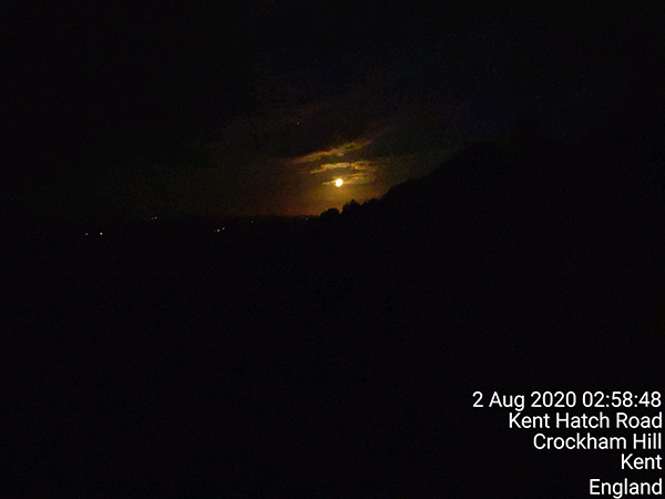
I really enjoyed the night. I always enjoy walking at night. I had a full moon lighting the countryside and was mostly listening to music and just having a good time. Occasionally I would see people but mostly I was alone.
The full moon as seen from the top of Crockham Hill in Kent
And then just before 4am I looked up and saw a sign – “Welcome to Surrey”!
I was in shock. I needed to walk another 100 meters or so before turning right but my rule said that I couldn’t enter Surrey (except for the three exceptions I have already mentioned). I checked my map on my phone. I wasn’t lost. I must have made an error with my route mapping. Or so I thought. I had been awake almost 24 hours and walking for over 21 hours and it never crossed my mind that I might be on a boundary road between two counties. All I knew is that I couldn’t enter Surrey. I walked back a few meters looking at the map on my phone to identify where I was.
There was a vineyard beside me and the map indicated that maybe I could walk through the vineyard and out on to the road that I wanted to be on. The other option was to backtrack what looked like a mile or so. I went with the vineyard option.
It wasn’t as easy as it looked on the map though. I managed to get into the middle of the vineyard but then found that I needed to jump down and over a small ditch – a one way option because I don’t think I would have been able to get back up the bank if I had had to. I walked alongside some vines for a while and eventually made it to the road. The only problem being that there was a tall blackberry and bramble hedge between me and the road. I decided to follow the hedge for a while hoping to find a gap that would allow me to get through to the road, and that is eventually what I managed to do. Reviewing my journey via Strava it appears that I was only in the vineyard for about 1,000 meters. Much better than backtracking to find another road, but completely unnecessary if I had thought to myself that it was a boundary road and I could have continued along my mapped route. But it was all a part of the adventure and gives me something to write about.
The blue line is my planned route and the black line is the detour I took through a vineyard because I didn’t realise that the road beside the vineyard was actually a boundary road and therefore I could walk along it.An satellite image of the vineyard in daylight. It looked very different at 4am!. The red light is the route I walked and the white line is the route I should have walked.
Soon after the vineyard incident I was looking for water again. It was 5am and I in Biggin Hill looking for hose taps and again I found one under what looked like someone’s bedroom window. I didn’t desperately need water but I figured that it would be better to get some now while I could steel it from someone’s hose tap than to run out when back out on country lanes. I still had about 18 or 19 miles until my next planned rest, which would be when I reached 100 miles – now likely to be around 27’ish hours into my adventure.
Sunrise!
Water bottles refilled, I was on my way again. For the next few hours, through until I reached 100 miles, I really started to struggle. The route was still very hilly, and I wasn’t enjoying the walk as much as yesterday. I was tired and wasn’t looking forward to what promised to be a long day. I always forget in these events, the second day of any multi-day race/walk is always the hardest.
I finally reached 100 miles just as I was entering Old Coulsdon and took that as an opportunity to stop for only my third decent rest.
100 miles! Taking a break in Old CoulsdonStrava map – leg 2Elevation profile leg 2 – total elevation change was 1,178 meters
Old Coulsdon to Kingston:
The direct route between Old Coulsdon and Kingston is only 13 miles. Only a half marathon. But for me it would be a very slow and painful 33 miles (53km) that would take almost 12 hours. As I said above, the second day is always the hardest.
I only rested for about 30 minutes in Old Coulsdon before heading off on sore feet. I can’t actually remember a huge amount about the Sunday other than that my feet hurt and I was very slow. I maintained reasonable progress in that I didn’t stop along the way, but it was slow. Throughout the day I averaged a pace of about 3 ½ miles (5.7km) per hour. It was still hilly and at times pedestrians out for a Sunday afternoon stroll would pass me!
My intention had been to arrive in Kingston sometime between late afternoon and early evening to meet Ruth and Jarrad and/or Zac for food. But I realised early on that that wouldn’t happen and made arrangements to meet them in Chessington at around 5pm as I thought a decent feed of macaroni cheese might be just what I needed. As 5pm approached I realised that I wouldn’t make it to Chessington in time either and called Ruth to change our meeting area to Tolworth. I’ve been through Tolworth hundreds of times over the years, both in the car and by bike and walking, but I was so tired and struggling to think that I couldn’t comprehend where I was arranging to meet them. In the end, I found a side street just off the road I was walking along and sat down outside a garden centre. I called Ruth and asked her to find the garden centre on Google maps and said I would be there.
A picnic in Tolworth – thanks to Ruth and JarradStrava map – leg 3aElevation profile leg 3a – total elevation change 405 meters
Ruth and Jarrad arrived after I had been resting for 15 to 20 minutes. Ruth had made macaroni cheese as promised and had also brought some hot water and facecloths to enable me to have a bit of a wash. I also repaired my feet, popped and taped a couple blisters, and changed socks and shoes.
After a total break of just over 1 ½ hours I headed off again. And I felt great! For about 20 minutes.
It took me almost an hour to get through to Chessington at which stage I had to turn left for the long out and back stretch down towards the M25 onramp which was just over the Surrey border. My plan was always to keep as close as possible to Surrey without crossing in to it, and as tired as I was, I stuck to my plan walking a pointless 4.7 miles (7.5km) return trip down to the M25 and back.
The hills were now finished (for the time being) and it was all downhill through Surbiton to the river, and then up to Kingston to the bridge over the Thames. But I was extremely tired now. I had been walking for 38 hours and even going downhill my average speed was about 19 minutes per mile (11:45/km). Additionally, going through Surbiton I found myself wandering all over the roads, and missing turnoffs.
Strava map leg 3b
I got to the Kingston Bridge a couple minutes before 10pm but decided that I would continue past the bridge and walk an additional 2 miles downriver to home where I would have some sleep. My original plan had been to walk through to at least 150 miles before sleeping because in races such as the Thames Ring 250 and Lan Las Ultra the first decent checkpoint for sleeping in at 150 miles, and I thought I would use this adventure as preparation for those events next year. My justification (in my exhausted state) for walking home to sleep rather than just sleeping on the side of the road was that if I stopped now I would get cold very quickly, so I either needed to keep walking or get indoors for a sleep.
That last 2 ¼ miles from Kingston Bridge to home took me 48 minutes! I was really struggling.
Once home, I told Ruth that I was going to have a shower and go to bed for a few hours and that I wasn’t going to set my alarm. I would just get up and go again when I was ready. If I was ready.
Elevation profile leg 3b – total elevation change 152 meters
Kingston to Aldershot:
My little toes were both sore so I decided to trial these Corn Wraps
I ended up sleeping for 9 hours, and when I after waking I took my time before heading out again. I had porridge and yoghurt for breakfast again, and then spent ages sorting out my stuff, fixing my feet again, and generally mucking around avoiding what was coming up. At one stage I made a comment to Ruth along the lines of “can you tell that I am putting it off” and she replied something like “well, it’s not a race” and that was all I needed to remind me that I was doing this for fun and adventure, and it didn’t matter how long I took (to complete the walk).
I finally restarted a little after 11am and took 36 minutes to walk back to Kingston Bridge. My ‘detour’ has taken a total of 13 ¾ hours.
The rest was just what I needed though, and whilst I was still walking at a relatively slow pace of a little under 4 miles (6.4km) per hour I was really enjoying myself. I walked for 6 hours before stopping beside the M25 at Wraysbury to eat a white chocolate magnum. I sat in the sun for about half an hour thinking how lucky I was to be able to do this. A year ago, I was just out of hospital after suffering from two blood clots and a lung infection, and now I was walking something in excess of 200 miles just because I can.
Stopping for a white chocolate magnum at WraysburyI ate plenty of blackberries along the way
An hour or so after restarting I reached Datchet and bought a sausage and chips for dinner, and then at 7:30pm I turned into Windsor Great Park. I had walked through Windsor Great Park before but hadn’t realised just how big it was. It took about 1 ½ hours to walk from one side to the other, although at the pace I was walking, that was only about 5 miles.
By the time I exited the park it was getting dark and as the night went on it got quite cold – down to 12 degrees if that could be called cold. I found myself shivering and put all my spare clothes on, which wasn’t a lot. I had a thermal top and a light rain jacket, and also a buff that I put on my head. I knew that I couldn’t afford to stop walking though because if I stopped, I would cool down very quickly. As always, just in case anything did go wrong, I was carrying a foil space blanket. I had learnt just how valuable this piece of emergency equipment was when I had to stop in the middle of the final night of the TR250 last year, and I always carry a space blanket when doing long overnight walks now.
Around 1am’ish I turned on to the A322 which turned out to be a duel carriageway with no shoulder, and it was two miles long! I was walking towards the traffic which was very light with one or two vehicles every 30 seconds to three minutes, but it meant that every time a vehicle came towards me I had to step up on to the grass beside the road and wait to for the vehicle/s to pass. It wasn’t easy to walk on the grass which was long and uneven, but if I had been walking on this road during daylight, with heavier traffic, that would have been my only option.
After this section the rest of the night was relatively uneventful. I wasn’t going fast, but I was enjoying things the best I could. My feet were sore and it would have been nice to stop, but stopping wasn’t an option as I needed to keep moving to keep warm.
It was a battle of mind over body and the mind was winning easily.
One of the things that people often say about long distance running/walking is that you need to know your “Why”, and my Why was that I had to complete this walk to get to my car. Stopping wasn’t an option and as such, negative thoughts never entered my mind.
During my long walks and races I have become known for stopping at any McDonalds that I pass along the way, but this walk had been largely along country lanes following closely to the Surrey border, and it wasn’t until I arrived in Aldershot on Tuesday morning that I came across my first McDonalds. Just in time for breakfast.
I bought a couple Bacon and Egg McMuffin’s, a hash brown, and an orange juice and went and sat in the sun across the road for one last rest before the final leg through to the finish.
McDonalds for breakfastStrava map – leg 4Elevation profile leg 4 – total elevation change 602 meters
The final leg – Aldershot to Grayshott:
One of the issues I had had from the beginning was that every time I charged my Garmin, the stopwatch would stop recording and couldn’t be restarted while the watch was charging. I’m sure that I used to be able to recharge it whilst in use, but for some reason that was no longer possible. As a result, I had recharged the watch while eating dinner at Gatwick on Saturday night, at my 100 mile rest on Sunday morning, at Tolworth on Sunday night and again at home on Sunday night, and now while having breakfast on Tuesday morning. This time I worked out that at the most I needed 40% charge in the watch to get through to the finish. I could probably finish with less than 30% but I didn’t want to take the risk so I rested until the watch was back up to 40% charge and then set off on the final 24 miles (38.5km) just after 8am, after a 1 hour rest.
Normally, even at a slow training pace, 24 miles wouldn’t take anything more than 5 ½ hours but this 24 miles was after I had already walked 195 miles (314km) in the previous 73 hours, and it also contained another 500 meters of elevation change.
I was still enjoying it and I was seeing countryside that most people will never visit. This was probably the best adventure I have ever had.
As much as I was enjoying it though, I was struggling. I was managing to walk about 3 ¼ miles (a little over 5km) an hour and was walking an even pace without needing to stop.
After just over 6 ½ hours I worked out that I had about 5km to go – only a parkrun to go. I wasn’t sure of the exact distance but when I crossed the A31 a couple hours earlier I knew that I had roughly 11 miles (18km) to go, and that was 8 miles ago.
It was just after 2:35pm on Tuesday afternoon, just over 80 hours since I started on Saturday morning. I figured that if I pushed the pace a little, I could ensure that I would finish in under 81 hours – because finishing ‘under’ x hours would be that much better than finishing ‘over’ x hours.
I picked up the pace the best I could, not realising at the time that I actually had 5.7km to go and that whole 5.7km was up hill!
I was feeling strong though. As strong as one can feel after almost 220 miles of walking, and the kilometers passed quickly. Coming in to Grayshott I still has five minutes left before 81 hours would be up. There was still probably 500 meters to go and it was all up hill.
I kept walking as hard and as fast as my legs would go. I arrived at the village hall and took my ‘finisher’s selfie’. The time; 3:34pm. 80 hours, 59 minutes and 14 seconds since I left the hall on Saturday morning. Total distance: 352km, 219 miles.
Surrey Circumnavigation completed.
Finisher’s photo! 80 hours 59 minutes and 14 seconds after my start photoStrava map – leg 5Elevation profile leg 5 – total elevation change 589 meters over just 24 miles with all of the last 5km being uphill
Some final thoughts:
Throughout the walk I relied heavily on the route I had mapped out using MapMyRun. Using the MayMyRun app on my phone I could see where I was relative to my planned route. I couldn’t have done this walk without this technology, especially given that I was effectively circumnavigating an invisible line.
In order to keep my phone charged throughout the walk, Zac had lent me his powerful USB charger. It weighed almost 500 grams but was probably the most important piece of equipment I carried other than my phone itself. I was using the phone so much that the battery would only last six hours without charging, and for a lot of the walk I just kept the phone charging while walking. The USB charge contained enough power to recharge both my phone and watch every time I needed it, although I did recharge the charger whilst at home on the Sunday night.
According to Strava analysis, actual walking time was 65 ½ hours.
Before starting, I had initially thought that I might have been able to complete the whole walk in around 65 hours, which would have seen me finishing late on Monday night. I think that if I had kept my Sunday night sleep to a minimum then I could probably have finished in under 75 hours. If I had managed things better and slept rough rather than taking the detour home, then that would have saved another 1 ½ or more.
Total distance walked was 352km/219 miles. When I measured the route on MapMyRun, it was 337km/209 miles. Approximately 50% of the difference was due to my detour to home, and the rest was due to miscellaneous course changes, getting lost, etc. Overall, I think I did pretty well keeping the actual mileage as close as I did to the planned mileage.
When I started on Saturday morning, I needed 350km to complete the double crossing of the Great Virtual Race Across Tennessee which I started on 1st May. During the Surrey Circumnavigation I moved from 715th place in Tennessee up to 320th, which was about the same place I was in when I completed the first crossing of Tennessee back in June.
One of the things I hadn’t realised when planning the route for this walk was just how few shops I would pass along the way. This was especially the case on the first day. I was carrying plenty of food through the walk though, and it was only water that I was ever concerned about running out of.
Total elevation change for the 352km/219 miles was 3,846 meters.
What’s next?
I wish I knew. Races are still being cancelled although some races are now starting up with social distancing rules. I enjoyed this adventure so much though that I am thinking I might do another county circumnavigation before the summer is over.